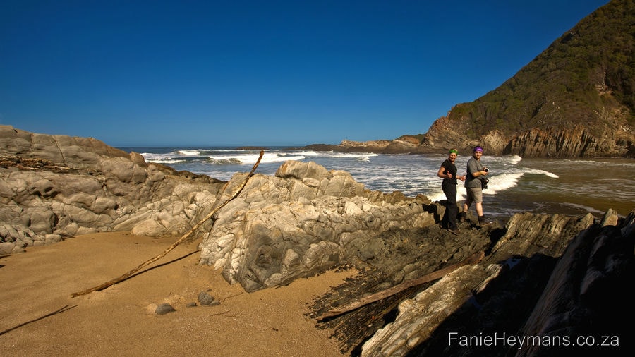
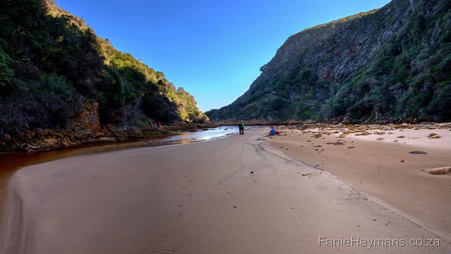
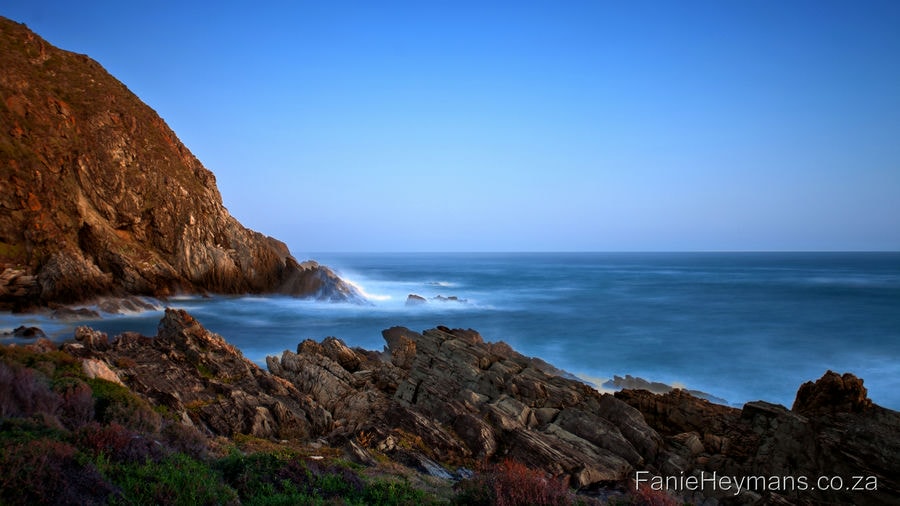
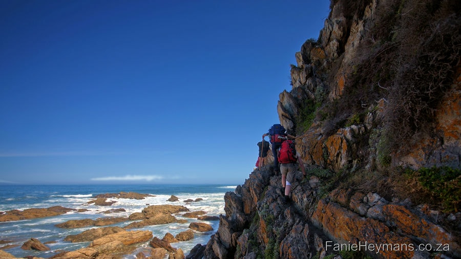
The Otter Hiking Trail is regarded as one of the top multi-day trails in South Africa. The area is renowned for its wild coastline, marine life, steep-sided gorges and verdant forests. It is a very popular trail among hikers. Whether local or abroad, and should be on every serious hiker’s bucket list.
The 5-day trail is situated on the coastal section of the Tsitsikamma National Park. Between Storms- River Mouth (starting point) and Natures Valley where it ends. The hiking trail is a total distance of 45km. The Otter trail is officially the oldest and undoubtedly the most iconic hiking trail in South Africa.
The Hike
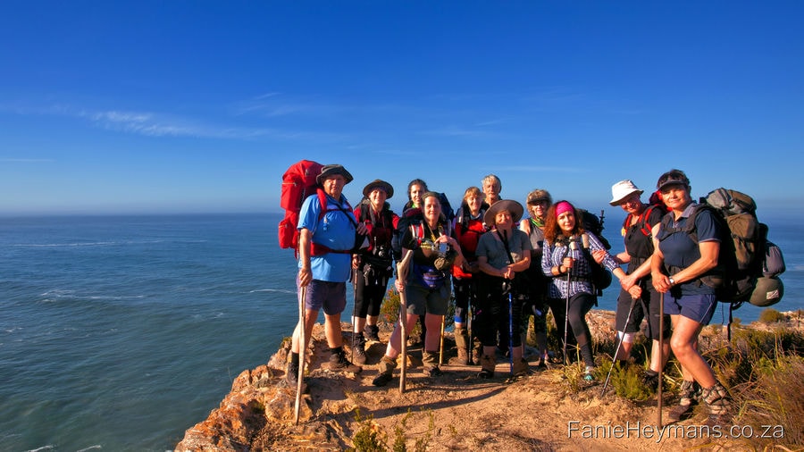
We were a group of 12 hiking friends, and arrived at Natures Valley the day before we started the hike. We made a reservation prior to the hike to be shuttled from Natures valley to Storms River Mouth. The company who has done the shuttle was very professional and friendly. On time, and dropped us off safely at Storms River Mouth.
It is one of the most scenic hiking trails that we have done by far. It is not for rookies, and one has to be very fit for this trail. The first day, is a short, scenic hike to the overnight hut. But do not let the short distance fools you.
The Otter Hiking Trail kicks off with a beautiful walk-through the forest. Once you hit the shoreline, you are in for some serious boulder hopping, up and down hills and ladders. This waterfall was our first pitstop for water and snacks. It forms part of the day visitors hiking trail, but they are not allowed to hike beyond this point. The landscape is breath taking, and the overnight huts have spectacular views.
Day 1 of the Otter Hiking Trail: Storms River Mouth Rest Camp to Ngubu Hut 4.8 km
Starting point of trail, forest walk,and then boulder hopping on the shoreline
Iconic waterfall, Ngubu overnight hut, and scenic view from hut
Day 2: From Ngubu Hut to Scott Hut 7.9.km
For most hikers, the second day of the Otter Hiking Trail is toughest, but it is very scenic.
For us, the second day proved to be a bit technical, but not that difficult. You are confronted with the first real challenge with some steep ascents and descents in the coastal forest. Day two is all about steps. Up hill with steps, down to the shoreline with steps.
We have started off on a beautiful sunshine morning. Once in the cool shades of the forest, the steps became somewhat difficult, as they differ in height. Some ladders will run over a stream. One has to be very careful as the can be slippery to walk on it, when wet.
Forest Walk
Be sure to walk across to the top of Skilderkrans (2km mark) for some spectacular panoramic views. The Otter Hiking Trail is full of bird life and surprises offered by the micro environment. Mushrooms with the most beautiful colours and shapes grows on the tree bark.
From Skilderkrans, the trail goes through its characteristic ascents and descents. Reaching the Kleinbos River with its sizeable pools and steep flanks. This is a good spot for a break and a swim. There are numerous streams and springs throughout the length of the Otter Trail that are suitable for drinking purposes. But please note the water from the Kleinbos River is not suitable for drinking.
Kleinbos River
Blue Bay beach at the 5km mark is an excellent lunch spot in sunny weather. The descent to the beach is steep. It is advisable to leave backpacks near the main trail if it is for a quick stop only. Unfortunately, we could not go down to Blue Bay, as the rain has suddenly came pouring down. We quickly had to put our rain gear on and cover our back packs before it got soaking wet! This is where the fun started. 🙂
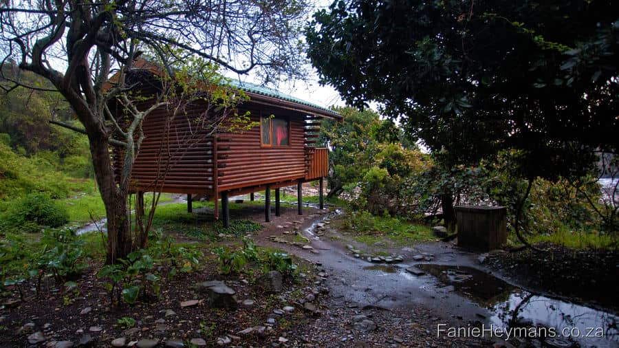
The trail was very slippery. When we arrived at Scott Hut, our boots were all wet, and we were cold, but in good spirit. The huts and bathroom are very well situated in the forest. It has a lovely view on the pebbly shore and ocean. It seems as if a fairy will pop out anywhere for the lush green shrubs and plants surrounding the campsite.
Scott Hut
Clothing and underwear of all different shapes and sizes were hanging inside our huts to dry.
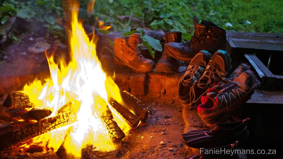
We placed our boots at the fireplace to dry. Each hut has a braai area with a sturdy steel grid, and firewood. After the cold showers, the warm welcoming fire was a sight for sore eyes, and warmed us up again. It was quite a technical day due to the rain. While everybody was preparing his or her own dinner, the day was discussed in detail. Adding the laughs and jokes, that kept the spirits high. Needless to say, we went to bed very early that night.
Day 3 Otter Hiking Trail: Scott Hut to Oakhurst Hut 7.7km
Day 3 of Otter Hiking Trail is possibly the best day on the Otter. With lovely cool and shady forested sections, several streams, a lovely tidal pool, walks along beautiful stretches of coastline and some visits to the plateau. It is the wildflower season during August and September, and wild flowers are flowering in abundance. The terrain is also not as technical as day 2. We bid Scott hut farewell, starting off early.
The trail starts off gradually with a mild walk on the shoreline, passing a tidal pool early in the day. If you want to explore this pool, it is worthwhile to bring a diving mask. Sea anemones and starfish inhabit the pool. There are a few rocky spots to pass, where the rocks are quite sharp. One has to be careful not to get injured when crossing this section. We stopped for a well deserve lunch break on a nice little beach. The soft sand at the Elandsbos River mouth.
Elandsbos River mouth.
Reaching the Lottering river crossing mid-afternoon, we were in luck, as it was low tide. We did not need to put our backpacks in survival bags and swim with them. Taking off our boots, and use water shoes though. (It is advisable to try and cross the Lottering River close to low tide).
As we start crossing the river, one of our friends, Lizl, got stuck in the muddy water. She could not get out by herself. The mud started to suck her in deeper, and she was quite terrified, and started to panic. Once we had calmed her down, we tried to get her out with our hiking sticks. We struggled at first, as the mud clang to her like cling wrap. But after a while, we managed to pull her out. What a relief!!
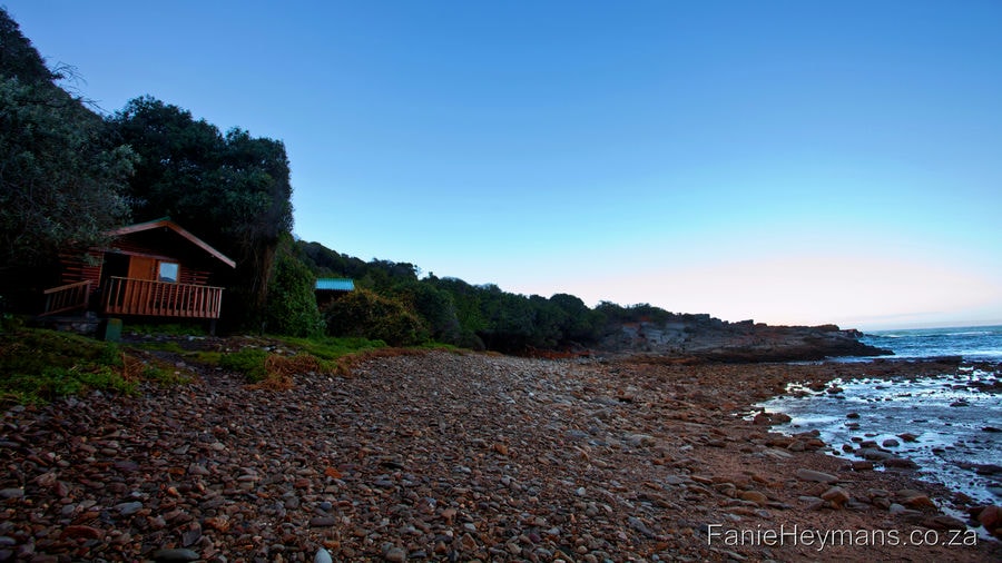
After the river crossing, the Oakhurst huts are close by and can be seen from the top of the hill. The huts are situated on a very scenic spot, with a beautiful unspoiled view of the ocean and surroundings.
Day 4: Oakhurst Hut to Andre Hut 13.8km
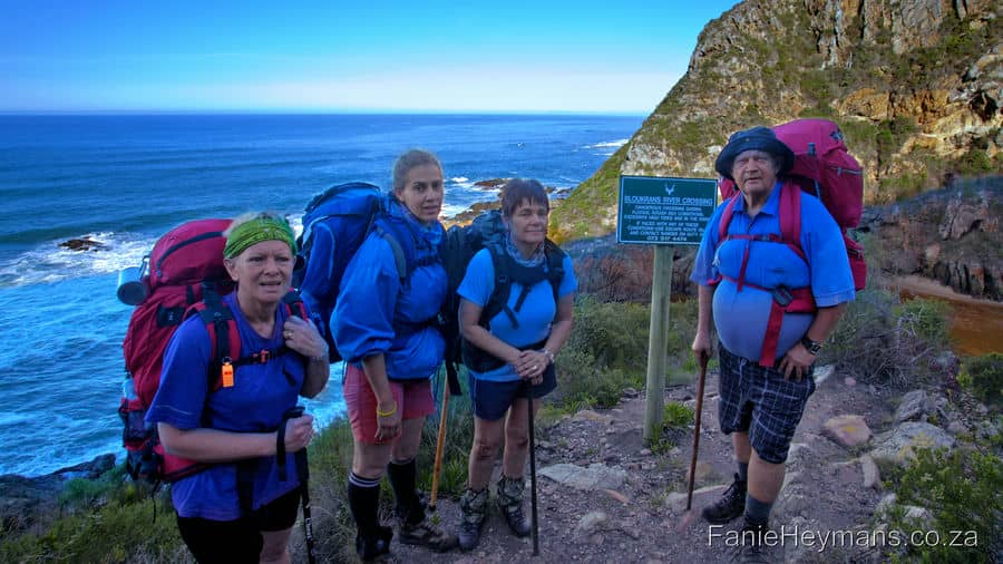
Day 4 Otter Hiking Trail presents the greatest challenge for both distance and river crossings. For me, day four was the most difficult day. The group started to hike at 4:00 am that morning and get to the Bloukrans River crossing when it was low tide, at 07:30. We walked with head lamps in the darkness of the early morning hours. It was 10 km from Oakhurst hut to the river crossing, and we had to pick up the pace.
The progress was very slow in the dark, as it was difficult terrain. At some places, there were steep cliffs next to the path. There were also hikers in the group who had a slower pace than others. They were not as experienced as others. We then had a quick group meeting, to decide who opt to go for the river crossing in time, and who not. 5 of us agreed to go (run so to speak) for the river crossing. The other 7 opted to take the escape route, to get to the next hut. The trail undulates through forest and dramatic coastal sections for the first 10km. After which the famous Bloukrans River crossing is reached.
Bloukrans River crossing
The 5 of us walked at a very fast pace, and did not stop until we had reached the hill overlooking the river. We got there in time, descent down to the beach. Back packs and boots had to be placed in the survival bags, and to put on water shoes as quick as possible. The water levels have risen surprisingly fast. We headed into the water, on our way to the slope that leads to the rest of the trail. By this time the water levels have risen to the level of my hips.
Fanie went ahead, to get his pack to the slope, and then come back to help me. But nature has its own way surprising you, twisting things around, and huge waves started to came in. The waves hits Fanie’s survival bag first. A sharp rocks under the water torn it apart, before he could safely put it on the rocks.
Me, the last one in, trying to keep my head above water:
The rest of us were following him, me being last. The next moment a huge wave hit me. It lifted me up and I could not feel any sand under my feet anymore. I am shorter than the hikers in front of me, so they could still stand. Water went over my head, and took my survival bag with. Then it was my turn to panic. For a few moments, I was so stunned. My legs turned into jelly, that I simply could not swim, and waves kept on pouring over me!!.
Fortunately, Tommie, saw my survival bag floating by, and got hold of it. Natasha, who was right in front of me, saw that I was in trouble. She hold her hiking stick out to me to grab onto. Fanie got to me to help me to the slope. Koekie and Natasha then also managed to get to the slope with the help of Fanie and Tommie. With the grace of God, we all reached the cliffs of the slope unharmed. No serious injuries-only minor cuts and bruises remained.
Adrenalin rush
Adrenalin was rushing through our veins, and we were all shaken up and soaking wet because of this ordeal. I was still trembling inside with shock, but stayed cool headed. I immediately thought that the people with me, must be feeling the same way! My response mechanism turned back on, and I had to do something to reduce the shock. We were totally drained of energy, and blood sugar levels were very low. We had consumed a lot of energy. Trying to get to the slope exit through the huge waves and unexpected high rising water levels, was traumatic.
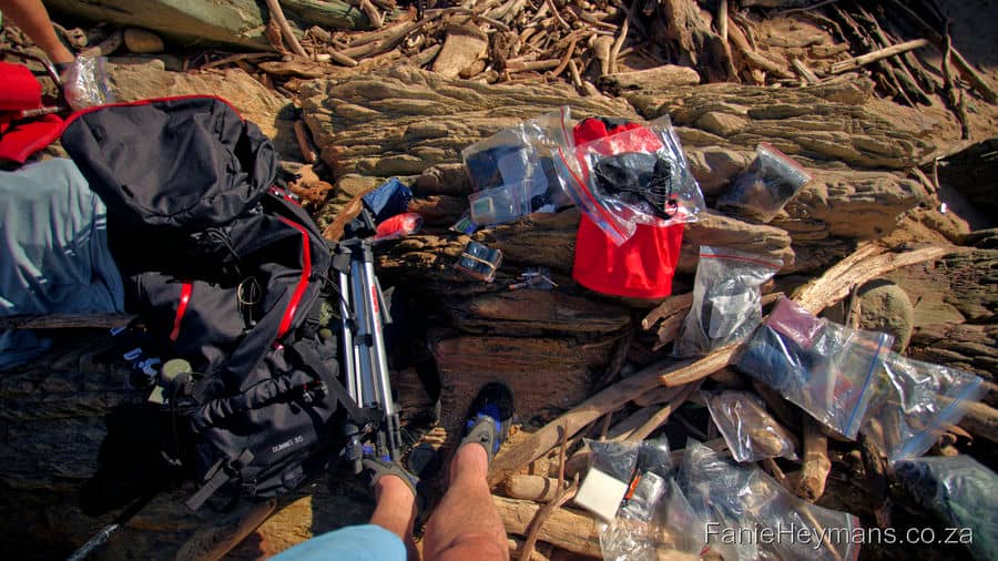
Between Fanie and I, we managed to give each one a small Bar One chocolate. This would prevent hypothermia and calm the nerves. We had to change to dry clothes. All of our survival bags were damaged by the sharp rocks under water, most of the things in our back packs were soaking wet too. Our cell phone and batteries were damaged, even though they were in zip seal bags. We had to break for a while to regain our strength, and get stuff to dry.
Wet Equipment
We were relieved that the crossing ordeal was over and done with. Surprise, as it was not over by a long shot. From the river crossing there is another 3.8 km ahead to the next overnight hut. This is the part of the trail where we hanged gecko style against the steep face of the cliffs. There are sharp pointy rocks, with only a chain/rope to hold on to. Your strength and endurance were again pushed to the limit. Did I mentioned that our packs were also heavier again because they were soaking wet? It became a steep and long climb to the plateau. The path then descends to Andre huts on the banks of the Klip River.
It was a never-ending story. The trail continued down to sea level. Then up and over hills again, some places without even a rope chain to hold on to.
Steep Cliffs
Once we have past this section of the trail, we walked on a pebbly beach. Here we stopped there for a few moments. There was a final uphill. A gentle walk on the plateau before we could finally decent to the last overnight hut.
Pebbly beach
Arriving at the hut, we met our fellow hikers all there, safe and sound. They even had a nice surprise for us. Giving each of us a well-deserved ice-cold cold drink and a snack. That was an awesome treat!! That night, around the fire, we had a lot to talk about. Sharing the joys, sorrows, encounters and hardships of the day with each other.
PS: If the river is flooding, or you arrive there when the tide is full and the sea is rough, do not attempt to go through. It is strongly recommended to rather make use of the escape route instead, labelled E6. The escape route climbs steeply to the top of the plateau. In the case of an emergency, it is recommended to make your way to the top of the escape route. Then wait for collection by SANParks Rangers once contact has been made. Do not attempt to walk to the N2.
Day 5 : Andre Hut to De Vasselot / Nature’s Valley 10.8km
This hut surely has the loo with the most scenic view of the ocean. We woke up, all very cheerful, as this is the last day of our hike. We all made it this far. (The encounters of the previous day, had slightly been pushed back into our memories for now). We made coffee and breakfast, and the we hit the last stretch of the trail. It starts with a short walk on a rocky beach, and then a steep climb up to the plateau. From there the trail stays mostly on top of the plateau on easy terrain. Rich fynbos and Erica’s are everywhere to see. Be on the lookout for king protea’s too. There are some good lookouts on the spectacular cliffs as you approach The Point.
The Point
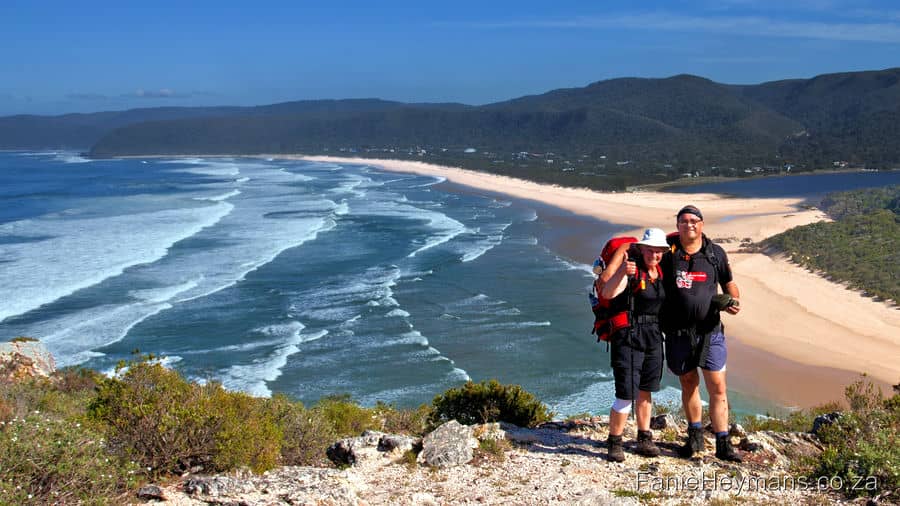
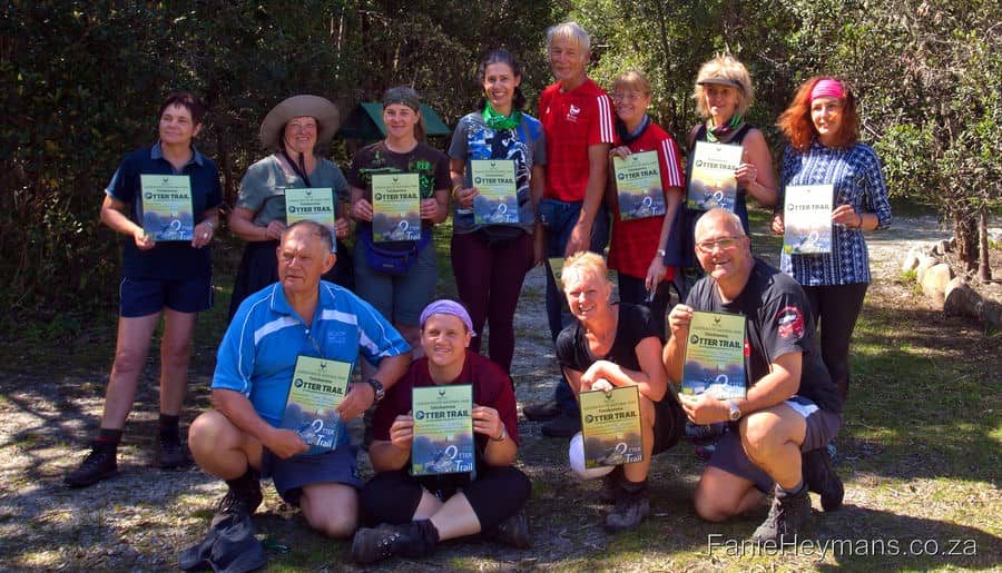
The panoramic views of the Groot River estuary and Nature’s Valley beach indicates the end of the trail. Another surprise awaits you after the descent, with 4km of beach walking left to De Vasselot. An appropriate time to celebrate and reflect on a remarkable trail. Then the trail leads you back into the forest on the way to SANPARK offices. There the group leader will sign the register, and hikers receives a certificate of completion. There are ablution facilities where you can shower as well.
What a spectacular hike, and to have been able to do it with such dear friends, was truly a privilege!
- Beauty: The definitive 5/5
- Difficulty rating: 7/10:
Key notes:
It is important to be aware of the dates and the times of the high and low tides. Prior to hiking the Otter Trail. This is especially important when it comes to crossing the bigger rivers. (The Elandsbos, Lottering and the Bloukrans Rivers). Inform group members of these crossings. Make them aware of the escape routes too (even though they are not easy either). It is recommended to obtain tide tables in order to prepare for the hike.
Check out the following websites for valuable information. SANPARKS, Hiking Forum SA, and All Trails
Travel Light, be fit, and make sure you have a camera, water shoes, and rain gear available.
Enjoy!!
Foot note:
The products/ food/ gear that are referred to, are things that we personally prefer to use, or helped us on our hiking expeditions, since we have started hiking. Personal preferences may vary from one hiker to the next, regarding gear, food and products used.
All information given above, is based on our personal experience, circumstances, observations and weather conditions of a certain hike.
It might differ from other hikers’ experiences, or different weather conditions and circumstances.


